Haere mai, haere mai, haere mai!
A trip to Northland and the Bay of Islands means you find yourself becoming immersed in the lyrical and poetic language that is Maori.
There is no better way to learn more than to take a trip out to the islands and to Cape Brett to see the spectacular Hole in the Rock, and probably meet up with some more of the locals, the amazing dolphins and birdlife.
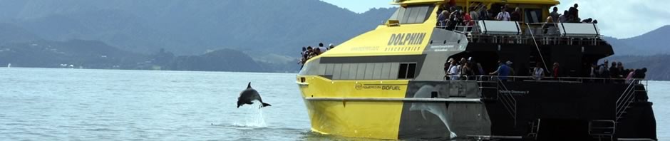
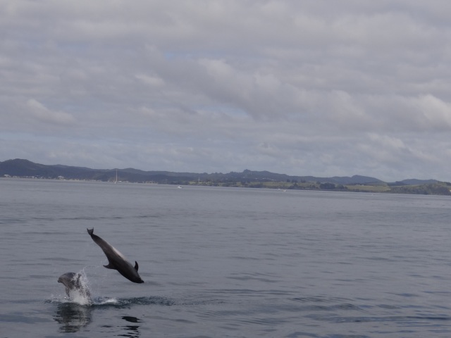
As you leave Paihia and Russell (Kororareko) and enter the Bay, you will start to see the islands (motu) unfold before you on a broad canvas. Keep your eyes peeled to help the crew find any sign of the local inhabitants, bottlenose dolphins, or less frequently, common dolphins.

A quick call from our friend (hoa) the skipper on DIII, the Swim with Dolphins boat, alerts us to a pod of dolphins. We speed up a little, but not enough to spook the dolphins, and enjoy a breathtaking display of acrobatics, and lots of wondering ‘who is watching who?’.
We leave the dolphins in peace after quite a while and start our voyage of exploration around the islands. First stop is Motuarohia. This was made famous in 1769 as the first point of call for Lieutenant James Cook in the Bay. He had originally bypassed the Bay on his way North, but gales forced him back to seek shelter. He found an ideal spot, with plenty of wood, food and water.
A short distance from Cook’s Cove we reach the lowest part of the island, which can often be close to becoming 3 separate islands with high tides and big swells, with stunning views, great place to drop sail and anchor.
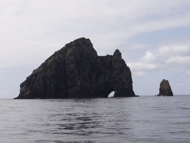
We head for Moturua, pausing briefly to admire the beautiful beaches and lush regeneration of native forest, (crucial in assisting the work of Project Island Song) before leaving Motukiekie on our left (port) and Urupukapuka to our right (starboard) before encountering a crescent-shaped beach on Waewaetorea. The sand is dazzling in its purity, the water quality so clear we can see stingrays settled in the sand, waiting for the next tasty morsel to pass by. Then it’s out through the impossibly narrow Okahu passage and throttle up to take us out to the end of the Cape Brett Peninsula and Motukokako (Piercy Island), with the showcase “hole in the rock”.
The school fish mass around the hole, great schools of Trevally and blue maomao gorging themselves on the abundance of food in the clear water. And what a colour that water is! A deep sapphire blue.

Our skipper Annie throttles up, inching the boat towards the hole, and then with a final surge we are in, then through and clear on the other side. It seems for a moment as if we can’t possibly fit, but with more than a slight sense of relief you realise how big this sea-carved cavern actually is.
We wind our way back along the peninsula,through the Albert channel, heading back to Urupukapuka, passing into the shelter of Otehei Bay.
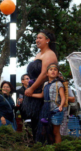
A quick run ashore allows those interested to engage in a Maori Guided Cultural Tour with Miss Kihi leading us through a story of her tangata whenua, and how they used the plants and the land to create a place to live for future generations.
After what seems far too short a time we are saying aroha nui to the islands of the bay, the area which has become my ipo…
ipo: (noun) lover, sweetheart, darling, beloved one.
E taku ipo, ka mau tonu taku aroha mōu kia hake rā anō taku tuarā/
My beloved, my love for you will remain firm until my back is bent. (PK wh173).
This slideshow requires JavaScript.
All images are copyright Explore Images 2012
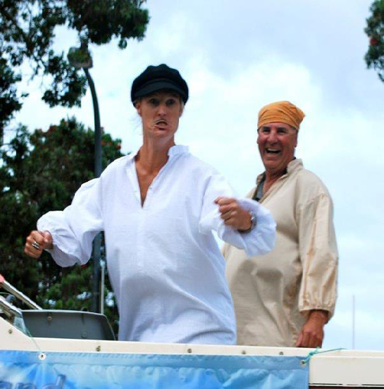
Thanks to the awesome crew of DV, Annie, Jono, Felix and Kihi, and the photographers on board, Dan and David, you guys rock!
Visit the http://www.maoridictionary.co.nz/ and for more information about the Bay of Islands the Department of Conservation have a great web site.
Maori words and place names are in italics, but may not be found in the maori online dictionary. It can look a bit hard to decipher at first, but the best way is to break a longer word into syllables, e.g. Urupukapuka, look for the repeating letters, and pronounce as Uru-puka-puka.
(Hope I got everything right, Miss Kihi!)